|

Susan Vajna, Professor, Business Information Systems
Crafton Hills College
September 2001
All information within this document has been used by permission from
Environmental Systems Research Institute, Inc., Redlands, California
The copyrighted information contained in this work is the exclusive property of ESRI.
ESRI Proprietary Rights Acknowledgment
The information contained in this work is the exclusive property of Environmental Systems Research Institute, Inc., 380 New York Street, Redlands, CA 92373-8100.
ESRI grants the recipient of the ESRI copyrighted information contained within these pages the right to freely use this information for classroom use.
GIS and Its Relevance to Business Majors
Notes to Business Instructors
WHY THIS PROJECT?? Many students majoring in business are looking for new business career options beyond the typical accounting, business law, marketing, and business administration courses taught at community colleges.? Many of you who teach in community college classrooms also expose students to applications software, workplace simulations and integration with the Internet, and Website design and development.? Furthermore, you have undoubtedly thought about developing, or are already teaching, courses in e-commerce.
Exposure to another area of study may prove exciting to students and lucrative to Business departments.? That area of study is GIS.
A career utilizing Geographic Information Systems is one of the fastest growing fields of study for geography and science majors.? It is, however, an area of study that has not yet caught the attention of Business instructors.? Yet it is an area that has caught the attention of many business owners and workers because of its efficient decision-making properties.
HOW I PROPOSE YOU USE THE GIS FOR BUSINESS MAJORS TUTORIAL? The tutorial document can be used as a handout for outside-of-class work, as a homework assignment, as a complement to the introduction of GIS in any business course, as an extra credit assignment, or as an instructor-led presentation.
NOTES ABOUT THE TUTORIAL DOCUMENT? The GIS for Business Majors tutorial document was originally created using Microsoft Word and is read only, with hyperlinks to a variety of Websites.? Copying this document to students? diskettes and instructing students to have the Internet active while working from this document will make all hyperlinks active.?
Because Internet Explorer and Netscape browsers will interpret this document differently, no .html version of this document is available for distribution.? Because Adobe Acrobat surrounds each hyperlink with a border, no .pdf version of this document is available for distribution.
RECOMMENDATIONS? If you copy this document to diskettes for distribution to students, it is recommended that you give an introductory demonstration of the maneuverability of this document.? Make certain that students (1) know how to open this file from the diskette, (2) know how to toggle off the Show/Hide button in Microsoft Word, (3) know how to click back and forward on their browser?s toolbar, (4) can identify hyperlinks, (5) know how to minimize and maximize windows, and (6) know how to zoom in and out of the document.
ABOUT THE TABLE OF CONTENTS? The table of contents follows and is included with these notes so that you can read a list of topics covered in the GIS for Business Majors tutorial.? The TOC is not hyperlinked.? It is recommended that you and your students explore topics in this document in the sequence in which they are listed, rather than randomly jumping from one topic to another.
Table of Contents
| Online Introduction |
Example of GIS Course Offerings |
Geography Matters!
|
Certificate Program at University of California, Riverside
|
| |
|
| Online Tutorial |
GIS Careers and Additional Resources |
What is GIS?
Who Uses GIS?
Industry Map Gallery
|
Associates and Societies
User Groups
Books and Periodicals
Glossaries
Directories
Building a Career
Internships
Recruiters
Jobs in GIS
|
| |
|
| Online GIS Activities |
GIS News, Events, Trends |
| |
Related News and Industry Events
GIS Day
Technology and Trends
|
| |
|
| (Online) Kinds of GIS Software |
Learn More About GIS |
What GIS Software Does
Free GIS Software
Commercial GIS Software
GIS Technology Standards
|
Foundations, References Global Positioning Systems (GPS) Online Tutorial Using ArcView GIS Software GPS Tutorial Online Tutorial from University of South Carolina Topographic Map Symbols Online GIS Store for GIS Books |
| |
|
| (Online) About GIS Data |
Free GIS Stuff |
Using Data in GIS
Why Data is Important
Data Types and Models
Selecting the Right Data
Links to Data Storage
|
|
| |
|
| GIS Training and Education |
Future of GIS |
The Right Training for Students
GIS Degree Programs
Instructor-led Training
Online Learning at ESRI's Virtual Campus
Self-study
GIS in the Classroom
Overview on About.com
Scholarships
|
|
| |
|
?

GIS for Business Majors
Where are our customers?
Where should our stores be located?
Where are our suppliers located?
Businesses need answers to lots of questions that begin with "where." GIS answers these questions more effectively than any other information technology by integrating a wide variety of data into one easily understood format?a map. The development of more powerful and affordable desktop computers coupled with the increased availability of business data has accelerated the use of GIS. Now more than ever, GIS means business.? http://www.esri.com/gisforeveryone/success/stories/business.html
|
INTRODUCTION
|

|
A. Geography Matters! > http://www.gisday.com/gisday/geography.html
1. Learn more about how GIS matters to specific industries
|
|
? Schools and Libraries
|
|
? Disaster Response
|
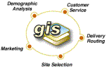
? Business
|
|
? Environmental
|
? Transportation/Logistics
|
|
? Law Enforcement
|
? Marketing and Sales
|
|
? Emergency Medical Services
|
? Electric and Gas
|
2. Learn how GIS affects your everyday life
See this entertaining and informative Shockwave Flash animation movie of 14 vignettes showing how GIS affects your life throughout an ordinary day in ways you never imagined!
3. Learn how GIS is for everyone
The GIS for Everyone book, CD, and accompanying Website introduces everyone to the concepts of GIS technology and its many uses.? Learn the basics of GIS technology.
- Download GIS software tools for free
|
- Share ideas with others learning about GIS
|
- Download GIS data for your neighborhood
|
- Discover the limitless possibilities of GIS
|
B.? GIS Is Key to Success for Many Organizations?
http://www.esri.com/gisforeveryone/success/stories.html
GIS projects come in all shapes and sizes and cover just about every industry. What is consistent between these projects is the success they have brought those that undertake them. On this Web page are just a few examples of what has been accomplished by others who started out with GIS.
|
TUTORIAL
|

|
http://www.gis.com/
An educational site and jumping station for information and advice on all aspects of GIS.? Note: You will find several of the hyperlinks in this document on this Website.
A.? What is GIS? > http://www.gis.com/
B.? Who uses GIS?
1.?? GIS through history > http://www.usgs.gov/research/gis/application1.html
2.?? Using GIS > Mapmaking > http://www.usgs.gov/research/gis/application2.html
3.?? Using GIS > Site Selection > http://www.usgs.gov/research/gis/application3.html
4.?? Using GIS > Emergency Response Planning >
http://www.usgs.gov/research/gis/application4.html
5.?? Using GIS > Simulating Environmental Effects >
http://www.usgs.gov/research/gis/application5.html
6.?? GIS for Your Specialty > http://www.gis.com/
 ???? ???? 
7.?? Specific Industries > http://www.esri.com/industries/index.html
Select a professional area of interest and learn why geography matters to each industry and how you can use ESRI's GIS technology in your specialty.
|
Business
|
|
Banking & Insurance
|
Real Estate
|
Retail & Commercial Business
|
|

|

|
|
|
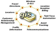
Communications
|
|
Location Services
|
Telecommunications
|
|
|

|
|
|
Educators
|
|

|
Libraries & Museums
|
Universities &
Community Colleges
|
|

|

|
|
Engineering
|
Environmental Management
|
|
Pipeline
|
Surveying
|
|
|

|

|

|
|
Government
|
|
Law Enforcement
|
National Government
|
Public Service
|
State & Local Governments
|
|

|
|

|

|
|
Health and Human Services
|
Transportation
|
| |
|
|

|

|
|
Natural Resources
|
|
Agriculture
|
Forestry
|
Mining & Earth Science
|
Petroleum
|
|
|

|

|

|
|
Utilities
|
|
Electric & Gas
|
Water & Wastewater
|
|

|

|
C. Industry Map Gallery
1.?? http://www.esri.com/mapmuseum/ > Index
|
Agriculture
|
Environmental Management
|
Petroleum
|
|
Business
|
Geology
|
Pipeline
|
|
Cartography
|
Government
|
Planning
|
|
Conservation
|
Health Care
|
Public Safety
|
|
Crime Analysis/Police
|
Local Government
|
Telecommunications
|
|
Disaster Planning
|
Military
|
Tourism
|
|
Electric/Gas
|
Natural Resources
|
Transportation
|
| |
Ocean/Seas
|
Water/Wastewater
|
2.?? Graphic display techniques > http://www.usgs.gov/research/gis/application6.html
|
GIS ACTIVITIES
|

|
A.? http://www.gis.com/ > Try GIS for Yourself
1.?? Links to Live Mapping Sites
You can try GIS in three ways:
2.?? ESRI?s ArcData Online
|
http://www.esri.com/data/online/index.html
ArcData Online is ESRI's Internet Mapping and Data Site. The ArcData Online site contains a wide assortment of geographic information that users can access to create map images and download data. ArcData Online is powered by ESRI Internet Mapping technology hosted in both the USA and Europe.
|

|
3.??? http://www.esri.com/data/online/mapstudio.html
ArcData Online enables you to access a wide variety of geographic data sets to display and download over the Web. ESRI is also building custom mapping applications that allow people to answer questions about their area of interest. We have placed a few of these applications in our ArcData Online Map Studio for users to access. Some map reports are free (such as the earthquake maps); others are fee-based (such as the flood maps). We will be adding other mapping applications to the Map Studio in the coming months. We hope you find the applications interesting and informative!
4.??? http://plasma.nationalgeographic.com/mapmachine/index.html
Each of the Map Machine?s dynamic maps is created on the fly, according to your specifications. This is possible through a technology known as geographic information systems, or GIS.
http://plasma.nationalgeographic.com/mapmachine/ > Resources and Links (located near the top of this Web page)
|

|
|
|
http://magma.nationalgeographic.com/2000/biodiversity/maps/index.cfm
|
|
http://www.nationalgeographic.com/maps/caward/
|
|
|
|
http://www.nationalgeographic.com/xpeditions/
|
|
http://www.nationalgeographic.com/maps/view/
|
|
http://www.nationalgeographic.com/stars/chart/
|
| |
B. Fun With GIS
1.?? http://gis.about.com/science/gis/cs/fun/index.htm
All work and no play makes for a very boring GISer. Take a break from your hectic day of mapping and spatial analysis with these fun links. Send a postcard, take a quiz or learn some trivia.
2.?? http://www.ssn.net.au/~garyradley/gis/gis_kids.htm > GIS & GPS for Schools
|
GIS SOFTWARE
|

|
http://www.gis.com/ > GIS Software
|
ABOUT GIS DATA
|

|
http://www.gis.com/ > Data for your GIS
|
GIS TRAINING AND EDUCATION
|

|
1.?? http://www.gis.com/ > Education & Training
- The right training for you
|
|
|
|
|
|
|
|
2.?? http://campus.esri.com/campus/tour/index.cfm?CFID=685948&CFTOKEN=46137661
Tour ESRI?s Virtual Campus to see what courses are offered online
3.?? http://gis.about.com/science/gis/cs/learninggis/index.htm > Learning GIS
With its multi-faceted approach, learning GIS can seem daunting. Fortunately there are wealth of approaches you can take to get started. From structured curriculums to distance learning and online tutorials, check here to find out more.
4.? Scholarships > http://gis.about.com/science/gis/cs/scholarshipsgis/index.htm
Typical course offerings for a certificate in Geographic Information Systems from the University of California, Riverside.
|
GIS CAREERS, ASSOCIATES, USER GROUPS
|

|
1.?? http://www.gis.com/ > Additional Resources
|
? Associates and societies
|
? GIS glossaries
|
|
? GIS user groups
|
? GIS directories
|
|
? GIS books and periodicals
|
|
3.?? Internships > http://gis.about.com/science/gis/cs/internships/index.htm
4.?? Recruiters > http://gis.about.com/science/gis/cs/recruiters/index.htm
5.?? Jobs in GIS > http://gis.about.com/science/gis/cs/jobs/index.htm
Job descriptions, how to survive a job interview, salary survey, building a career
|
GIS NEWS, EVENTS, TRENDS
|
|
http://www.gis.com/ > News/Events/Trends
|
LEARN MORE ABOUT GIS
|

|
1.?? Foundations of GIS > http://gis.about.com/science/gis/cs/basics/index.htm
2.?? References for GIS > http://gis.about.com/science/gis/cs/reference/index.htm
3.?? GPS - Global Positioning System > http://gis.about.com/science/gis/cs/gps/index.htm
- Global Positioning System (GPS) is a technology that uses the locations satellites to determine locations on earth. GPS is an essential tool for GIS because it allows for the gathering of data that locationwise is highly accurate.
- Links to online GPS tutorials, equipment, and other resources.
4.?? Online Tutorial using ArcView software from Institute for Geoinformatics, University of M?nster, Germany?> http://castafiore.uni-muenster.de/vorlesungen/av_tutor_e/index.html
5.?? GPS online tutorial > http://www.trimble.com/gps/fsections/aa_f1.htm
6.?? http://www.gis.sc.edu/gis/avshtcrs/handouts.html
Short course tutorial from University of South Carolina, pages 8-10, An Introduction to GIS Concepts.? (If you haven?t already done so, download the free Acrobat Reader from Apple?s Website to view this tutorial.)
7.?? Topographic map symbols > http://mac.usgs.gov/mac/isb/pubs/booklets/symbols/
8.?? http://www.gis.com/ > Online Store (for GIS books from ESRI)
|
FREE GIS STUFF
|

|
http://gis.about.com/science/gis/cs/freegis/index.htm
All of the costs involved to learn GIS, purchase hardware and software, and obtain data can be a bit disarming. Listed here are some completely free GIS related resources.
|
FUTURE OF GIS
|

|
http://www.usgs.gov/research/gis/application7.html
For online GIS training, go directly to http://campus.esri.com on the official Environmental Systems Research Institute, Inc., website. ESRI?s Bookstore
Choose the Books link on ESRI?s home page http://www.esri.com to see what books, workbooks, and other resources are available for purchase directly from Environmental Systems Research Institute.
|